
This checklist for Drainage Area Map specifies information that must be included in this drawing for a particular residential or industrial facility drainage system.
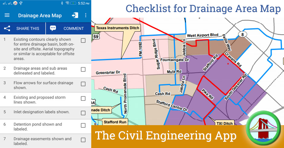
| Sr | Check Item | Done |
| 1 | Existing contours clearly shown for entire drainage basin, both onsite and offsite. Aerial topography or similar is acceptable for offsite areas. | |
| 2 | Drainage areas and sub areas delineated and labeled. | |
| 3 | Flow arrows for surface drainage shown. | |
| 4 | Existing and proposed storm lines shown. | |
| 5 | Inlet designation labels shown. | |
| 6 | Detention pond shown and labeled. | |
| 7 | Drainage easements shown and labeled. | |
| 8 | Zoning indicated for all offsite areas and/or land use assumptions specified. | |
| 9 | Rational Method Peak Runoff Rate Computation Table shown (Q=KCIA). | |
| 10 | Time of concentration and weighted runoff coefficient calculations shown as needed. | |
| 11 | List the total site impervious area (Sq.Feet. of all paving, roof areas, etc.) – Commercial Projects. | |
| 12 | Erosion Hazard Setback, FEMA 100-yr floodplain, and Fully Developed 100-yr floodplain delineated. |